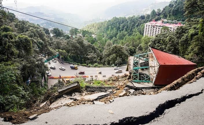
Shimla, April 9 — A study by IIT-Ropar scientists has warned that landslides in Himachal Pradesh could double by 2050, threatening nearly 21% of the state’s area, up from the current 11%. Using Artificial Intelligence and mathematical modelling, the researchers linked the alarming trend to unplanned urban growth and climate change.
The study predicts severe ecological shifts: nearly 27% of the state’s current snow and ice zones may transform into barren land, while 19% of dense forest could give way to sparse vegetation. Built-up areas, now covering 8% of the state, have grown from 5%, while water bodies are expected to shrink, with 5% changing into sparse forest and another 2% into urban and agricultural land.
“Anthropogenic land use is pushing the hills to the brink,” said Reet Kamal Tiwari, one of the lead researchers. “Himachal’s terrain is now more prone to failure due to expanding construction, soil sealing, and vegetation loss.”
Tiwari called for urgent changes in land use policies. “The government must release more open-source data. That would help scientists better assess the impact of changing land cover and inform mitigation policies.”
The study notes that road projects, illegal hill-cutting, excessive earthwork, and mining are behind many of the state’s fatal landslides. Even low-slope areas, once considered stable, are becoming increasingly vulnerable.
“The rising temperatures are bringing more extreme weather—droughts, floods, and heat waves—that further accelerate landslide risk,” said Tiwari. He urged the Himachal Government to prioritise the creation of hazard maps to guide safer urban planning and build climate-resilient infrastructure.
Scientists believe only sustainable development measures, combined with data-driven planning, can avert future disasters.