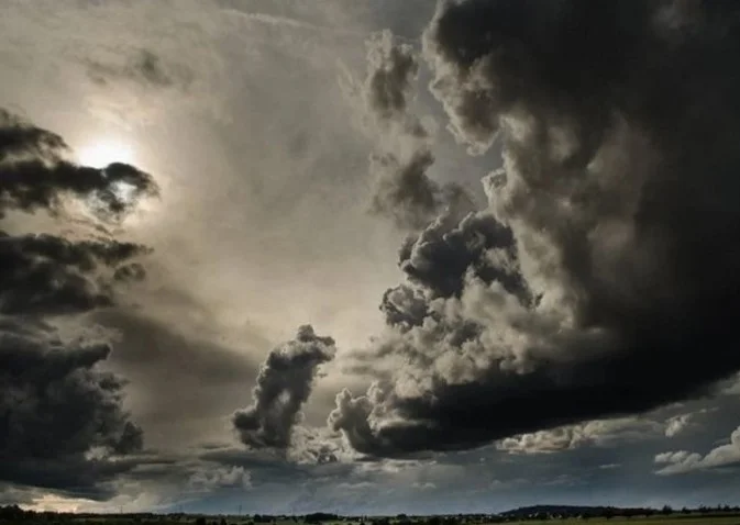
CHANDIGARH, May 9 — The India Meteorological Department has issued a yellow alert for Chandigarh, Punjab, and Haryana, effective from May 11 through May 14. Forecasters stated that the region should prepare for thunderstorms, lightning, and gusty winds reaching speeds of up to 50 kmph, accompanied by light rainfall in isolated areas.
The meteorological office maintained that while Sunday is expected to remain settled with partly cloudy skies, weather activity will intensify at the start of the work week. Monday and Tuesday are projected to see the most significant weather disruptions before conditions begin to stabilize on Wednesday. Meteorologists affirmed that the upcoming weekend is likely to return to dry conditions with no active warnings in place.
Temperature trends indicate a warming phase, with a predicted rise of 4 to 5 degrees Celsius in maximum temperatures over the next three days. Experts stated that the Tricity area—Chandigarh, Mohali, and Panchkula—will see daytime highs hovering between 35°C and 37°C. Despite this increase, current data shows that seasonal rainfall since March has remained significantly above normal, reflecting an unusually active pre-monsoon period.
Regional data from the past 24 hours confirmed a dry spell, though maximum temperatures varied across the states. Sirsa emerged as the hottest station in Haryana at 39.4°C, while Bathinda recorded the highest temperature in Punjab at 39.1°C. Officials affirmed that while days and nights are trending hotter, the impending thunderstorms may provide brief localized relief from the climbing heat.