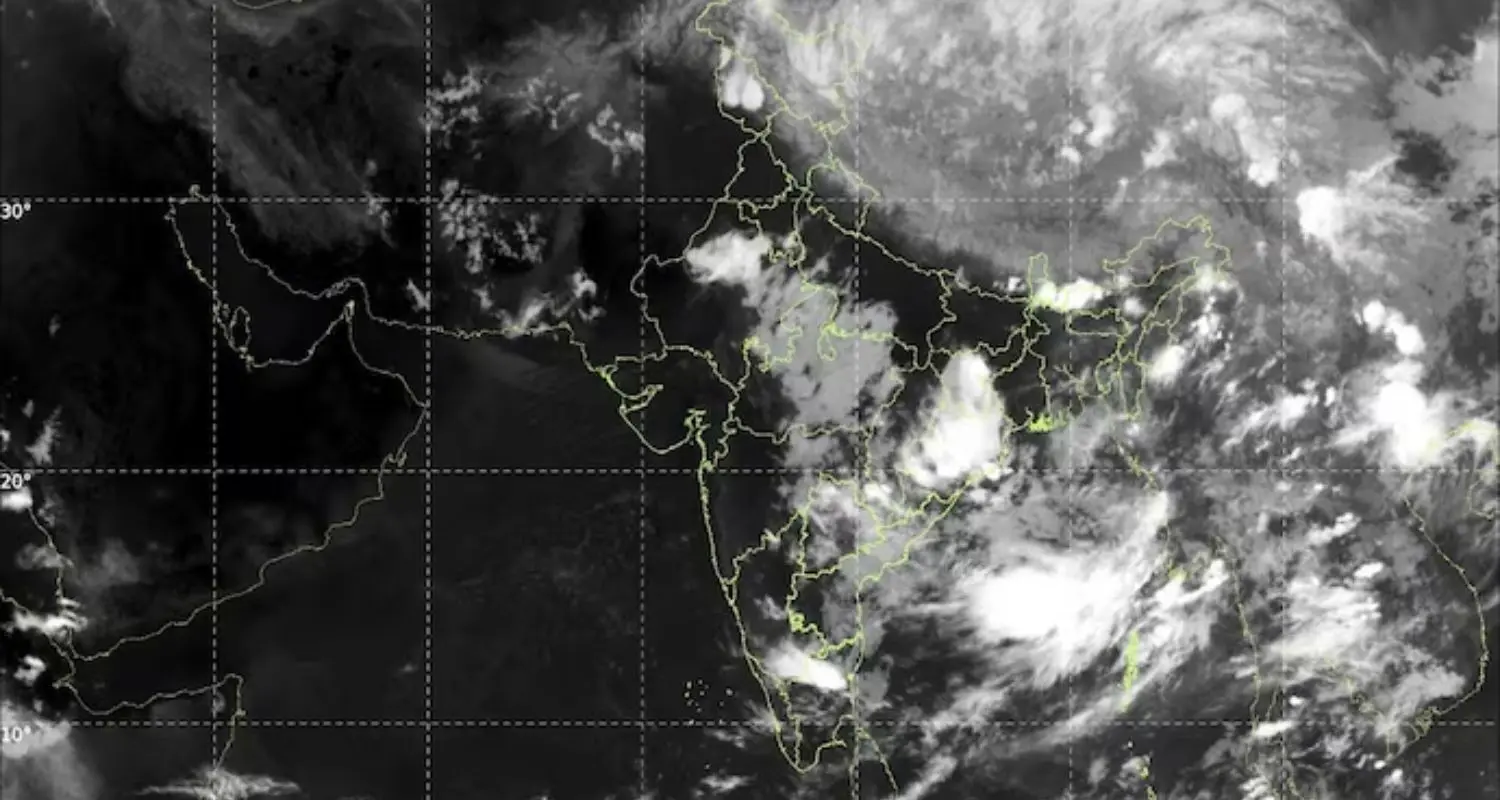
Chandigarh, June 15: India’s southwest monsoon is experiencing an unexpected slowdown, with official data revealing a 28 percent shortfall in precipitation across the country during the opening phase of the season. According to figures compiled by the India Meteorological Department, actual rainfall recorded between June 4 and June 14 reached only 34.3 mm, contrasting with the long-term historical average of 47.7 mm for this ten-day window. District-level mapping indicates that extensive belts across central India, the eastern states, and the southern peninsula are bearing the brunt of this dry spell, with very few localities managing to mark average or surplus volumes.
Meteorological experts stated that this sluggish movement is occurring despite the monsoon successfully advancing into certain sectors of central and southern India over the last few days. Weather scientists noted that the primary obstacle is not a lack of moisture in the region, but rather an ongoing conflict between upper atmospheric wind systems. Analysts explained that a fast-moving upper-air current known as the west wind jet has drifted much further south than its typical seasonal position.
This structural shift has directly blocked the growth of the opposing east wind jet, which serves as a major driver for monsoon circulation. Without this steering mechanism, rain-producing weather systems have remained weak, leaving them unable to push deep into the mainland. Consequently, lengthy dry periods have emerged over agricultural regions that normally experience rising monsoon activity at this time of year. Meanwhile, isolated northern and western districts have experienced brief showers, though these were triggered by localized atmospheric disturbances rather than the broader monsoon system.
The growing deficit has generated concern within the scientific community, as the current situation deviates from the healthy start projected in the long-range outlooks released in May. Most seasonal models had predicted a strong opening phase, citing supportive oceanic variables. Instead, unexpected upper-level wind configurations have created an obstacle to that progress.
Meteorologists maintained that there is still cause for optimism as the month progresses. Specialized weather models suggest that the upper-level easterly jet stream could regain strength after June 20, which would help restore the monsoon’s forward momentum. If this shift materializes, rain systems over the Bay of Bengal are expected to move inland, allowing the monsoon to reorganize and distribute moisture more evenly across the subcontinent.